Avian Habitat Loss + the Climate Crisis in NYC by Eva Perez de Vega


80-99%
decline in abundance of grassland bird species since 1966 due to habitat loss + degradation
+1.5*C
Imminent
+2.0*C
2050
+3.0*C
2080
Climate change exacerbates the global biodiversity crisis, with an anticipated rate of change 20x faster in the next century than in the past 2 million years.
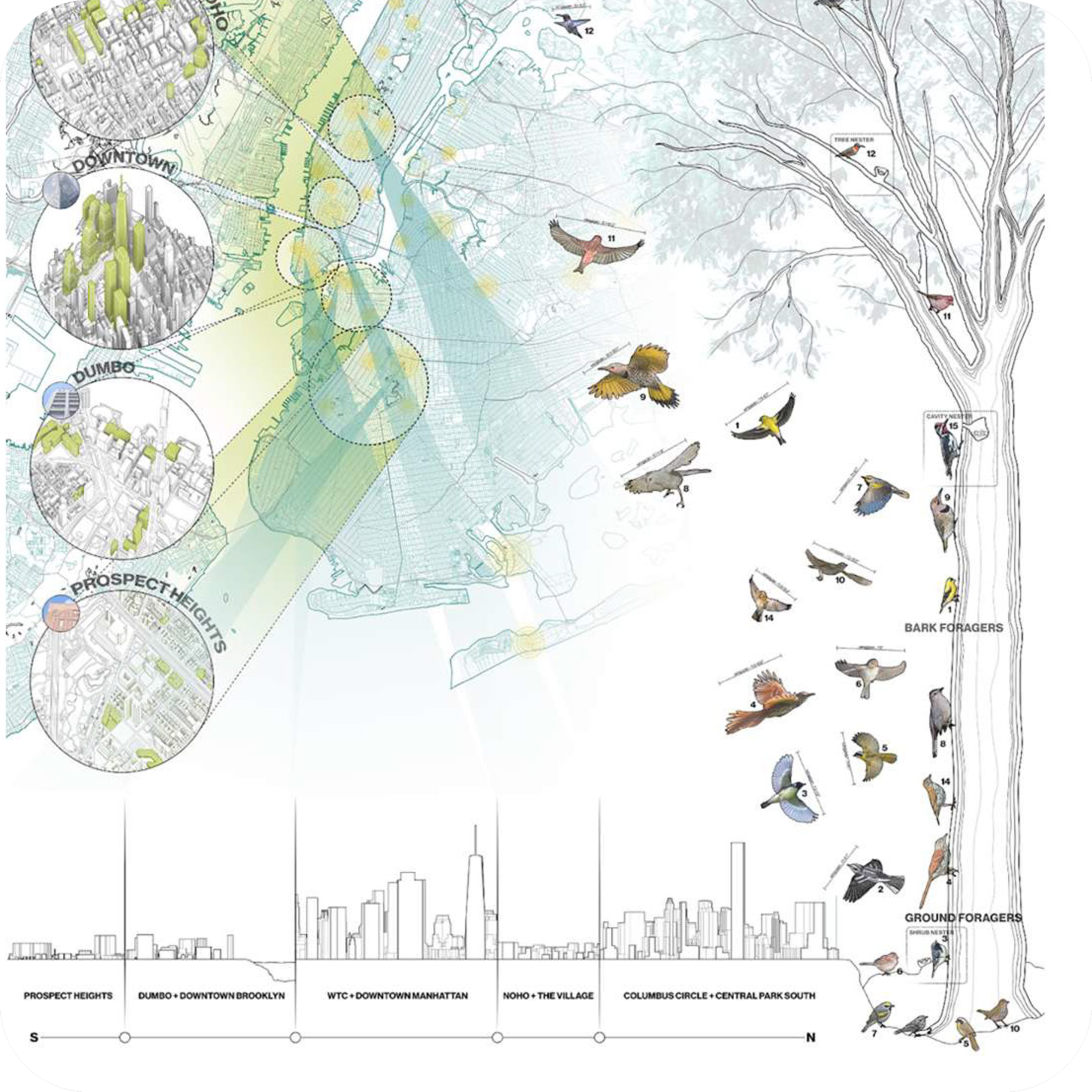
The Atlantic Flyway
The Atlantic Flyway is 1 of 4 major migratory flyways in North America, passing through New York, Washington DC, Philadelphia, and Boston metropolitan areas.
The Flyway is a bi-annual highway for multiple types of birds beyond what we typically see flying through our cities. Migratory birds include:
Land birds + birds of prey
Shore + wading birds
Seabirds + gulls
Waterfowl
Yet human urban sprawl shifts the annual rituals of migration whether it be through habitat loss + degradation or the rise in avian collisions with the built environment (different building types/ facades throughout NYC).
